Group Details Private

CzechGlobe

  • Windy brings a real-time global lightning strikes tracking

    Windy has been buzzing with activity recently, tirelessly innovating to enhance your experience. This time, we're focusing on something that strikes—quite literally—lightning.⚡️

    Collaborating with industry experts to bring you yet another game-changing layer, we've partnered with Nowcast.de, a worldwide lightning detection provider.

    If you have a comprehensive overview of the lightning strikes situation, you have a very good overview of the weather situation.* Richard Fellner, CEO of Nowcast.

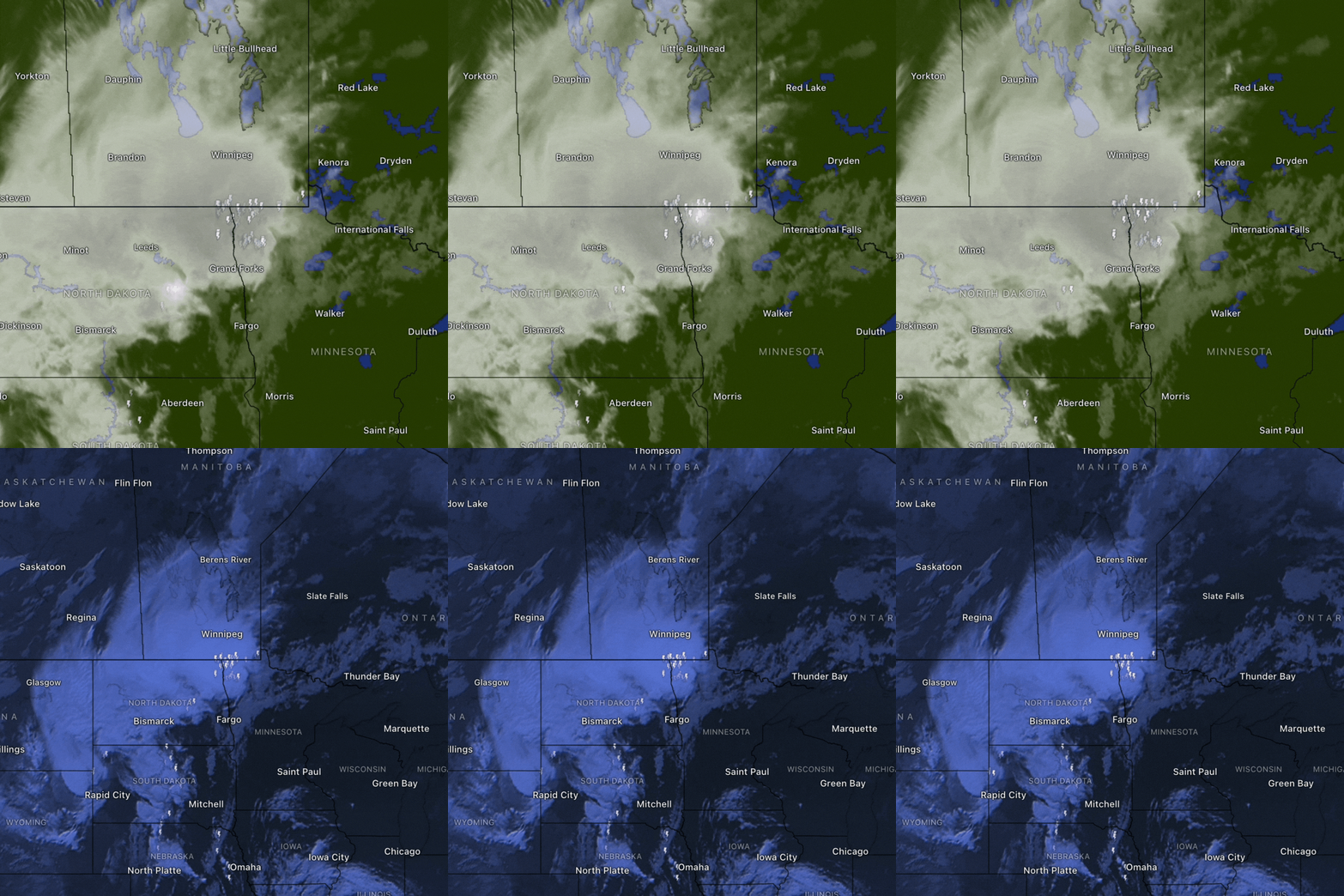
    As a result of this collaboration, we’re able to present you with a lightning strike overlay for Weather radar and Satellite that shows real-time lightning activity right in your vicinity. And again, the lightning detection layer is totally free for everyone!

    See our short video with a few words from Richard Fellner, the CEO of Nowcast:

    Coverage? It's global!

    We are proud to say that the coverage of the lightning detection network is GLOBAL.

    However, there are still a few limitations. Marginal coverage is over the Pacific Ocean, the eastern part of the Indian Ocean, the northern part of the Atlantic Ocean, and the southern part of Argentina.

    Why is lightning detection important?

    Access to high-quality lightning information offers invaluable benefits for both professional and everyday users. For professionals like pilots, glider pilots, and sailors, precise data on approaching thunderstorms is crucial for ensuring safety and making informed navigational decisions.

    Meanwhile, everyday users also stand to gain significantly; accurate storm warnings allow them to seek shelter in a timely manner and take steps to safeguard their property.

    _center

    💡 Quality meets accuracy. The moment a lightning strike hits the ground, it's reflected on the Windy map with a maximum delay measured in mere seconds.

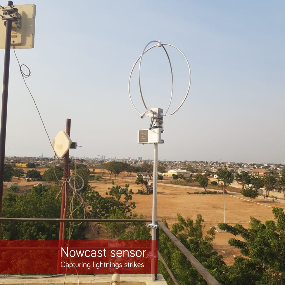
    Example of what a lightning sensor looks like.
    _center

    Support us by buying Windy Premium

    Premium features take you one step further, making you ready when your big day comes. Whether you're an athlete, pilot, sailor, or weather enthusiast. Plus, your Premium subscription helps us continue to provide essential features like lightning detection to all users free of charge.
    Go Premium now

    https://www.windy.com/cs/-Meteoradar-radar?radar,50.111,14.406,5,internal

    posted in Announcements article lightning lightningstrike nowcast
  • Satellite outage: US and TW

    There is currently an outage of satellites over the US and Taiwan. We are waiting for further development.

    posted in System Status outage satellite
  • Typhoon Haikui on track to hit Taiwan

    Hurricane Idalia: Update September 2, 1:00 pm UTC

    Haikui ( also known as Hanna) is getting closer to Taiwan and is expected to make landfall on Sunday. The typhoon had already reached category 2, but then slowed down again to category 1 on the Saffir-Simpson scale. The danger is still significant, as indicated by the Rain accumulation layer.

    Compared to the original forecast, the eye of the typhoon is moving more to the south. You can follow the details of the trajectory on the hurricane tracker. Landfall of the typhoon is expected on Sunday.

    Watch Typhoon Haikui Live with Hurricane Tracker🌀

    Haikui is the new typhoon that has formed east of Taiwan and intensified into a category 1 storm in the last 24 hours.

    As of Friday, 1st of September, Haikui is moving west-northwest towards Taiwan with maximum sustained winds of 80 mph.

    Most of the models by JMA, ECMWF, and UKM predict the landfall to take place in eastern Taiwan on Sunday. While forecast by BoM-A models that the storm will pass Taiwan north without going inland.

    _center

    Note: Any Windy.com footage can be freely distributed.
    When sharing, please credit the source or tag Windy.com in your post or article.

    Central Weather Bureau is expected to issue a sea warning later on Friday and a land warning early on Saturday.

    Over the weekend, from Saturday to Sunday, sporadic and localized precipitation is expected nationwide. However, regions in northern Taiwan and the elevated terrains of the northeast are more susceptible to experiencing intense or even torrential rainfall.

    https://www.windy.com/-Hurricane-tracker/hurricanes/haikui?22.829,123.126,6,internal

    posted in Articles article typhoon taiwan storm
  • Saola is passing very close to Hong Kong

    Update: 1st of September, 11:30 am UTC

    Typhoon Saola has intensified to category 4 and will pass very close to Hong Kong and Guangdong province as a super typhoon in the following few hours. Maximum sustained winds are 140mph.

    The storm is expected to bring significant storm surge, urban flooding, and strong winds.

    Watch Typhoon Saola Live with Hurricane Tracker🌀

    alt text

    Update: 31st of August, 11:30 am UTC

    Super Typhoon Saola is beginning to approach Hong Kong; landfall is expected in the next 24 hours. The typhoon should slightly weaken to category 2 as it grazes the coast.

    The trajectory of the storm is increasingly veering towards the west, heightening the likelihood that it may bypass Hong Kong to the south.

    While a landfall in eastern Guangdong would minimally affect Hong Kong's metropolitan regions, a southern passage could present different implications.

    Watch Typhoon Saola Live with Hurricane Tracker🌀

    alt text

    Note: Any Windy.com footage can be freely distributed.
    When sharing, please credit the source or tag Windy.com in your post or article.

    Update: 30th of August, 9:30 am UTC

    Typhoon Saola began approaching the southern tip of Taiwan, bringing heavy rain and strong winds to the area. Landfall, however, is not expected. The typhoon should continue its trajectory toward China.

    Saola remains storm category 4; sustained winds are 155 mph. Forecasts from JMA, BoM-A, and other models predict weakening once the passes along Taiwan. JMA forecasted the storm should arrive in Hong Kong as typhoon category 2, but further weakening is very much possible.

    Watch Typhoon Saola Live with Hurricane Tracker🌀

    alt text

    Update: 29th of August, 10:30 am UTC

    Saola will cross the Babuyan Islands in the northern Philippines over the next 24 hours as it moves westwards towards China. The storm maintains its Category 4 status with sustained winds of 140 mph.

    Forecasts from all 4 weather models (JMA, UKM, BoM-A, and ECMWF) show the storm will not directly hit Taiwan’s mainland on Wednesday, but its outer bands are expected to graze the island's southern cities.

    Watch Typhoon Saola Live with Hurricane Tracker🌀

    alt text

    Note: Any Windy.com footage can be freely distributed.
    When sharing, please credit the source or tag Windy.com in your post or article.

    Taiwan's meteorological institutions have released advisories concerning severe rainfall and robust wind currents, with particular emphasis beginning on Wednesday. Warned of high waves and swells, making boat journeys dangerous.

    Prolonged downpours are forecasted to impact Taiwan's eastern and southern territories, spanning from Wednesday to Thursday. Additionally, there is a possibility that the typhoon will strengthen further when it passes Taiwan, according to ECMWF forecast track.

    The typhoon is then expected to proceed towards China's southern Fujian and Guangdong provinces.

    Update: 28th of August, 7:30 am UTC

    After traveling in a loop near northern Luzon, Philippines, since Thursday, Saola has significantly strengthened and reached Category 4 status. The storm is affecting the northern Philippines with heavy rain and flooding in low-lying areas with a wind strength of 130 mph. Saola is now expected to weaken and continue tracking east of The Philippines.

    The latest forecasts from JMA, UKM, BoM-A, and ECMWF agree on the northwest direction toward Taiwan and Hong Kong. It may hit the southern tip of Taiwan on Wednesday and China's southern coast on Thursday.

    Watch Typhoon Saola Live with Hurricane Tracker🌀

    alt text

    Note: Any Windy.com footage can be freely distributed.
    When sharing, please credit the source or tag Windy.com in your post or article.

    The future intensity of the typhoon remains unclear; it could either escalate back to category 4 or maintain its status as a category 1 or 2. Meteorological predictions have yet to reach a consensus.

    Taiwan plans to release a sea warning and possibly a land warning as the typhoon approaches.

    https://www.windy.com/-Hurricane-tracker/hurricanes/saola?satellite,20.365,119.048,6,internal

    posted in Articles typhoon saola taiwan hong kong article
  • Typhoon Lan Set to Hit Japan's Main Island

    Update: 14th of August, 5:30 am UTC

    Typhoon Lan is anticipated to make landfall on Japan's primary island, Honshu, near Osaka, by Tuesday. The Japan Meteorological Agency has issued warnings as the typhoon approaches, with residents in the Tokai and Kinki regions being particularly advised to brace for intense rainfall.

    As of Monday morning, the typhoon was progressing northwest off Cape Shionomisaki at a speed of 16km per hour, and it boasted winds reaching up to 161km/h near its core, equivalent to typhoon category 2.

    Thunderstorms are predicted along the Pacific coast of both eastern and western Japan through Tuesday; rainfall could reach up to 20cm within the next 48 hours.

    https://www.windy.com/?33.142,134.529,6,m:eBMajVI,internal

    posted in Articles article typhoon lan typhoon lan
  • Delayed UKV model

    The UKV model update is delayed, latest data are from 3.8.2023.

    posted in System Status delay ukv
  • Typhoon Khanun batters Okinawa and Taiwan

    Update: Thursday, 3rd of August, 11:00 am UTC

    The 6th typhoon of the year, typhoon Khanun, is a category 2 equivalent typhoon currently on a weakening trend, located west of Okinawa. Maximum sustained winds are 121 km/h. The system is now bringing strong winds and rain to China and Taiwan.

    Up to 20 centimeters of rainfall is expected in the next 24 hours in Okinawa as the system moves closer again.

    Use layer Rain accumulation under the Rain, Thunder category to check the rain forecast values:

    1. Go to the side menu with layers
    2. Click Rain, Thunder to expand the category
    3. Click on Rain accumulation right under it

    The forecast indicates that the Khanun should slowly turn eastwards into Okinawa again on Friday and weaken to a category 1 typhoon. The eye of the typhoon is expected to stay offshore, sparing China and Taiwan from further impacts.

    Track the typhoon with ➡️ Hurricane Tracker

    Typhoon, which reached category 4 in the previous days, caused significant damage as it crossed Okinawa Prefecture, disrupting power and transportation.

    https://www.windy.com/-Rain-accumulation-rainAccu?rainAccu,next3d,28.014,122.739,6,i:pressure,internal

    posted in Articles article tyohoon typhon khanun
  • RE: Premium subscription - no calendar

    @synergyph Hello, it is possible to see the 12 months Satellite history. If you do not see the Archive option on the Satellite layer, please share a screenshot.

    posted in Your Feedback and Suggestions
  • RE: Home airport name change

    @halleffect said in Home airport name change:

    Greene County Regional Airport is now KCPP

    Hello, please contact https://ourairports.com/ for the name change.

    posted in Bug Reports