Hanna weakens into a tropical storm
-
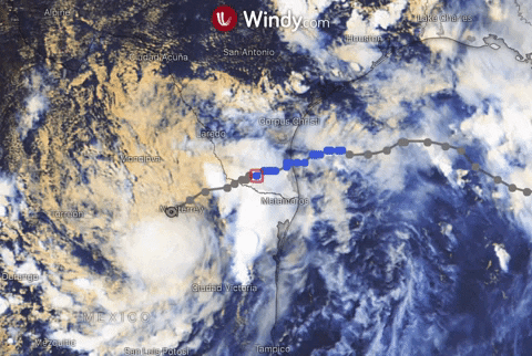
Update: 26th of July, 10:00 p.m. UTC
Hanna has downgraded into a tropical depression with winds speeds around 55 km/h (30 KT) and position at 25.6N 100.6W.
Heavy rainfall should continue over south Texas and northern Mexico.
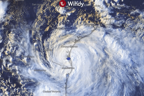
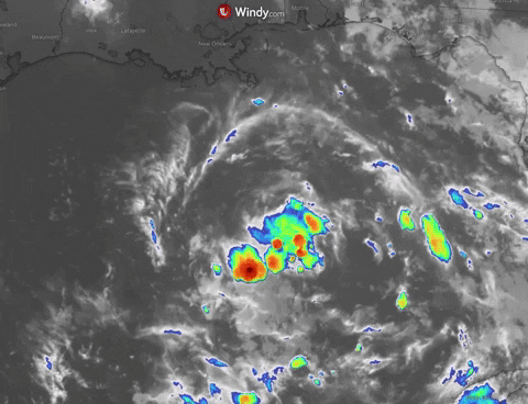
Update: 26th of July, 01:00 p.m. UTC
Tropical storm conditions are forecasted to continue for several hours near the center of Hanna, which is currently located at 26.3N 98.9W with maximum sustainable winds 110 km/h (50 KT).
Threat remains also for the coast of Texas and northeastern Mexico, where Hanna will produce heavy rains bringing dangerous flash flooding and river flooding.
Texas coast can on the other hand expect decrease of storm surge today.
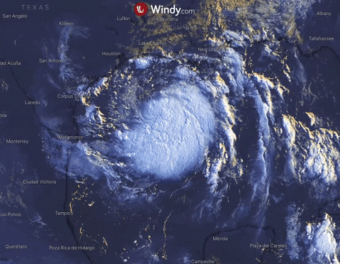
Update: 26th of July, 01:00 a.m. UTC
Hanna approached Padre Island, Texas as a hurricane Category 1, it is currently moving westward across South Texas with position at 26.7N 97.5W.
Maximum sustainable winds are 138 km/h (75 KT) and movement speed 12 km/h (8 KT).
Severe conditions continue to deteriorate across the majority of Texas, main threat is life-threatening storm surge for areas from Port Mansfield to Sargent and flash flooding due to the excessive rainfall. Flooding rainfall is expected to extend into Sunday.
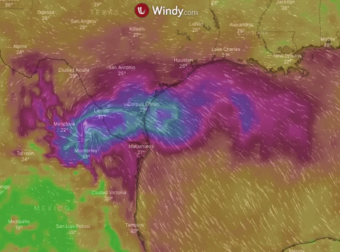
Update: 25th of July, 07:00 a.m. UTC
Currently located at 27,0N 95.3W, Hanna moves toward the Texas coast near 13 km/h (7 knots). Turn toward the west-southwest is expected by tonight and continue on Sunday. The landfall with a hurricane strength along the Texas coast is forecasted for Saturday afternoon. Rapid weakening is expected after it moves inland.
Maximum sustained winds are near 100 km/h (54 knots) with higher gusts. Tropica-storm-force winds extend outward up to 130 km from the center.
Hurricane conditions are expected along the Texas coast from Port Mansfield to Mesquite Bay. There is a danger of life-threatening storm surge from Baffin Bay to Sargent. Heavy rains which could result in life-threatening flash flooding and isolated minor to moderate river flooding are expected over portions of southern Texas and northeastern Mexico.
Update: 24th of July, 9.30 a.m. UTC
Tropical Depression Eight has reached tropical storm strength, becoming the eighth named cyclone of 2020 Atlantic season.
Its movement near 15 km/h (8 knots) is toward the west-northwest and it's expected to turn toward the west tonight, followed by westward motion through the weekend.
Maximum sustained winds are 65 km/h (35 knots) and it's forecasted to increase as Hanna makes possible landfall along the Texas coast on Saturday. Then it's expected to steadily weaken after Hanna moves inland.
Hanna is expected to produce heavy rains across portions of southern Texas. This could result in flash flooding and isolated minor to moderate river flooding. Tropical-storm-force winds are forecasted to portions of the Texas coast, in the area of warning effect.
Update: 23rd of July, 9:00 a.m. UTC
Tropical depression 8 has formed in the Gulf of Mexico on Wednesday with a high potential to become a tropical storm Hanna within next 36 hours.
The storm is likely to make landfall along the Texas coastline early this weekend.
Maximum sustainable winds are 46 km/h (25 KT) and movement speed 14 km/h (8KT).
Once TD8 strengthens, it could bring tropical-storm-force winds along the Texas coasts and heavy rainfall with flash flooding to parts of Louisiana and southern Texas.