Burevi weakens as it moves across India
-
Burevi has weakened as it moves across the southern tip of India. Currently located near 9.3N 79.6E, toward the west-southwest, the system is moving near 4 km/h (2 knots).
Maximum sustained winds are near 55 km/h (35 knots).
It is forecasted that Burevi will strengthen after it emerges into the Arabian Sea over the weekend.
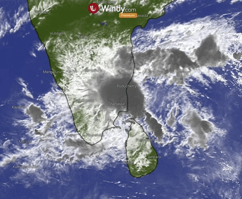
Update: 3rd of December, 11.30 a.m. UTC
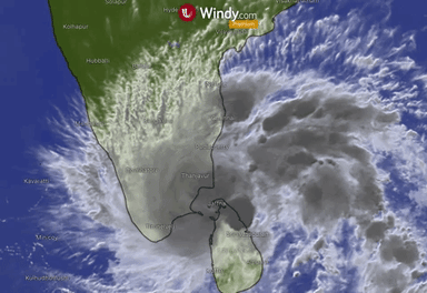
Tropical cyclone Burevi, located 9.2N 79.8E is moving near 16.6 km/h (9 kt). Maximum sustained winds are near 65 km/h (35 kt).
The system is moving over water that has favorable conditions, expected to intensify slightly before making landfall along the coast of southern India. Then it is forecasted for Burevi to begin to weaken as it moves over land. The system will then enter the Arabia sea.

Update: 2nd of December, 4:30 p.m. UTC
Tropical cyclone Burevi, the fifth cyclone in the North Indian Ocean this year, is located near 8.8N 82.3E and currently making landfall in Sir Lanka with maximum sustainable winds of 74 km/h (40 kt).
Cyclone is then expected to travel towards India and approaching the Tamil Nadu coasts Kanyakumari and Pamban on early December 4.
Heavy to extremely heavy rains are forecasted in Tamil Nadu and Kerala till December 5. However Burevi is expected to be the least destructive cyclone of this year.
https://www.windy.com/-Wind-accumulation-gustAccu?gustAccu,9.947,71.016,6,internal