In-fa makes landfall in eastern China
-
Update: 25th of July 2021, 1:00 p.m. UTC
Typhoon In-fa has made landfall in the China’s Zhejiang Province on Sunday with damaging winds and heavy rains.
Maximum winds are 101 km/h (55 kt) with higher gusts.
Typhoon landed in the Putuo district of the city of Zhoushan and caused flooding, power outages and relocation of more than 1 milion people.
Update: 24th of July 2021, 10:00 a.m. UTC
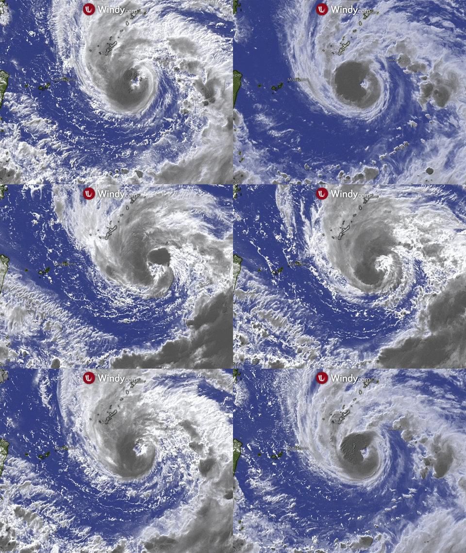
Weakening typhoon In-fa is currently tracking away from the southern Japanese islands, but could bring heavy rainfall to the eastern China by the end of weekend.
Typhoon is located near 27.3N 124.3E with maximum winds of 120 km/h (65 kt).
Rain and winds affecting the Japanese islands will persist into Saturday. In-fa will likely affect eastern China beginning Sunday. Landfall is expected between Shanghai and Wenzhou, bringing heavy rain and strong winds.
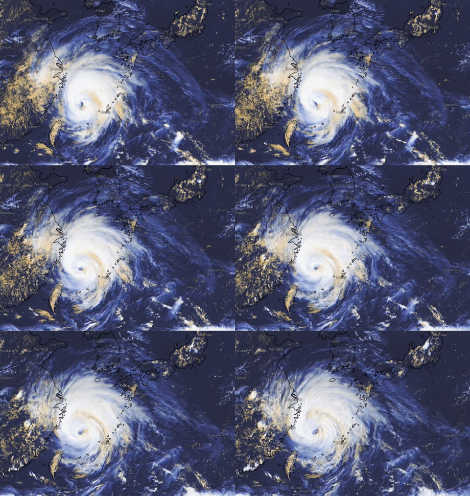
Update: 23rd of July 2021, 1.30 p.m. UTC
Located near latitude 24.6 North longitude 125.1. East, In-fa is moving northwestward at 4 knots (7.4 km/h).
Maximum sustained winds have decreased to 80 knots (148 km/h).
Turn towards north-northwest followed by a westwards turn with a slight intensification to 85 knots ( km/h) is expected. The system should then start gradually weaken as it approaches the China coast.
Interaction with the land will lead to rapid weakening and eventual dissipation.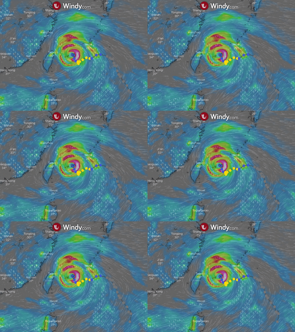
Update: 22nd of July 2021, 11.30 a.m. UTC
Typhoon In-fa, located near latitude 23.5 North 125.9 East, is currently moving towards the west near 2 knots (4 km/h).
Maximum sustained winds have decreased to 85 knots (155 km/h).
The conditions are favorable enough for the system to restrengthen on Friday. It is forecasted that In-fa will reach a peak intensity of 90 knots (165 km/h) as it passes over the Yaeyama and Miyako Islands on Friday afternoon.
The system should begin to steadily weaken as it approaches the eastern coast of China this weekend and become a tropical storm before making landfall south of the city of Ningbo in China's Zhejiang province on Sunday morning.
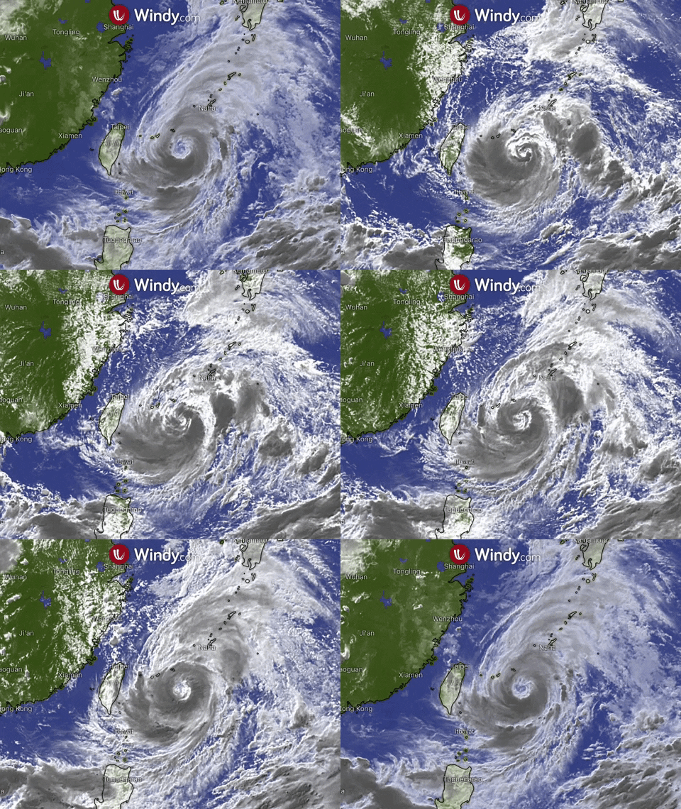
Update: 21st of July 2021, 11.00 UTC
Located near latitude 24.2 North longitude 127.3 East, Typhoon In-fa is currently moving westward near 3 knots (6 km/h). The cyclone is expected to peak at 105 knots (195 km/h), possibly to strengthen into the equivalent of a Category 3 major hurricane, before it reaches the Yaeyama Islands.
Maximum sustained winds are near 95 knots (175 km/h).
A turn toward the northwest is expected as In-fa moves across the East China Sea this weekend. The cyclone will begin to steadily weaken while it's passing Taiwan to the northeast on Saturday and making landfall over the Zhejiang province of eastern China on Sunday morning.
Then the system should start rapidly weaken, bringing heavy rainfall to the region through the beginning of the next week.
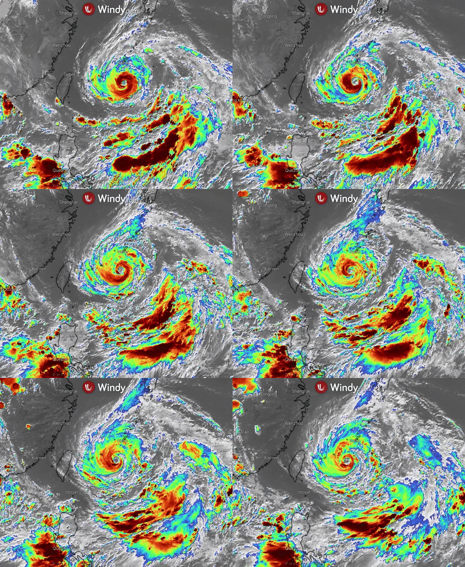
Update: 20th of July 2021, 11.00 a.m.
Typhoon In-fa (Fabian), currently located near latitude 24.7 North, longitude 129.7 East, is moving towards the west near 10 kt (19 km/h).
Maximum sustained wind are near 65 kt (120 km/h).
The system moves through a favorable environment which will be conducive for further development as it passes to the south of Okinawa this evening and draws closer to the Miyako and Yaeyama Islands.
Some, possibly rapid intensification to 95 kt (176 km/h), is expected as it passes over the Yaeyama islands.
The system will then gradually weaken and begin to track northwestward. This track will bring In-Fa along the northern tip of Taiwan and into mainland China on Saturday.
https://www.windy.com/-Wind-accumulation-gustAccu?gustAccu,28.004,117.664,6,internal