Windy Community
    • Unread
    • Categories
    • Groups
    • Go to windy.com
    • Register
    • Login

    Propose a NEW LAYER / FEATURE You'd like on Windy

    Scheduled Pinned Locked Moved Your Feedback and Suggestions
    90 Posts 52 Posters 114.1k Views 6 Watching
    Loading More Posts
    • Oldest to Newest
    • Newest to Oldest
    • Most Votes
    Reply
    • Reply as topic
    Log in to reply
    This topic has been deleted. Only users with topic management privileges can see it.
    • gcombetteG Offline
      gcombette
      last edited by

      A 'TEMSI' like display for pilots :-) some layer that somehow summarizes and highlights all kind of dangers for flights.
      (https://www.lavionnaire.fr/CodesTemsi.php)

      1 Reply Last reply Reply Quote 3
      • A Offline
        arjannv
        last edited by

        First of all: What a great website, keep up the good work!

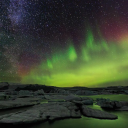
        It would be nice to have a Aurora overlay.
        Data is available at NOAA: https://www.swpc.noaa.gov/products/aurora-30-minute-forecast

        And additional for stargazing/night photography:
        Multiple data sources might be combined to a Aurora + Clouds + Day/Night + Lightpolution overlay.

        Lightpolution data: http://pmd.gfz-potsdam.de/contact/showshort.php?id=escidoc:1541893&contactform

        1 Reply Last reply Reply Quote 0
        • N Offline
          nimvh
          last edited by

          If the page automatically refreshed that would be fantastic. Nothing more annoying that watching all my other weather websites stay up to date but this one I have to manually refresh.

          Tomber42T 1 Reply Last reply Reply Quote 0
          • Tomber42T Offline
            Tomber42 Moderator @nimvh
            last edited by

            @nimvh There are many auto refresh plugins for many browsers available..try this..

            Greetings from Tomber

            1 Reply Last reply Reply Quote 0
            • robertgskinnerR Offline
              robertgskinner | Premium
              last edited by

              Topographic isolines ?

              idefix37I 1 Reply Last reply Reply Quote 1
              • idefix37I Offline
                idefix37 Sailor Moderator @robertgskinner
                last edited by

                @robertgskinner
                If you zoom completely you find topographic isolines. However I have not check it on all countries.

                Gkikas LGPZG 1 Reply Last reply Reply Quote 2
                • Gkikas LGPZG Offline
                  Gkikas LGPZ Moderator Meteorologist @idefix37
                  last edited by

                  Also, I want to add that topo. isolines are not a weather layer.
                  When Michal.Koldinsky asked to:
                  "Propose a NEW LAYER / FEATURE You'd like on Windy"
                  I think he means weather related layers.

                  1 Reply Last reply Reply Quote 4
                  • captainjim47C Offline
                    captainjim47 @PaulHarder2 | Premium
                    last edited by

                    @paulharder2 experienced 50F in fog off Santa Cruz CA meanwhile in the upper yacht harbor it was 100F only 5 nm away.

                    Capt. Jim Fuller
                    Yacht & Boat Delivery
                    Marine Electronics
                    Los Gatos, CA

                    1 Reply Last reply Reply Quote 1
                    • aderobinsonA Offline
                      aderobinson Sailor
                      last edited by

                      Firstly, excellent app - well done.
                      I’d like to suggest adding an ‘Anchor watch’ button on the main screen that records initial GPS position and then tracks movement against predefined settings for boat size and Alarm radius.

                      I think it would be a great feature that sailors could set and adjust based on forecast for overnight anchorages.

                      1 Reply Last reply Reply Quote 1
                      • aderobinsonA Offline
                        aderobinson Sailor
                        last edited by

                        It would be great if we could do route planning between 2 points based on wind direction over the course of the route, showing optimum turn (tack and gybe) points.

                        May even be a feature people would pay a reasonable fee for (In app purchase).

                        jaffadogJ 1 Reply Last reply Reply Quote 1
                        • jaffadogJ Offline
                          jaffadog API developers @aderobinson | Premium
                          last edited by

                          @aderobinson check https://fastseas.com for routing with windy.com weather visualizations.

                          1 Reply Last reply Reply Quote 1
                          • N Offline
                            noalt
                            last edited by

                            I propose some form of split screen functionality.

                            Press a button, and the map view is divided into two parts (The viewable area in both parts is always the same).
                            For example: you can set the left view on cloud mode, the right view on wind at 1500m.
                            So you can compare two aspects at the same time.

                            How does this sound? Not easy probably :-)

                            1 Reply Last reply Reply Quote 2
                            • gorbachsvG Offline
                              gorbachsv
                              last edited by

                              Hi, it would be very interesting to see a map of forest and steppe fires on the example: "http://fires.ru", a map of snow and ice cover: "https://www.star.nesdis.noaa.gov/smcd/emb/ snow / images / metop / eurasia / recent / metop_avhrr_4km_ea_daily_blnd_fulres_recent.png "

                              Gkikas LGPZG 1 Reply Last reply Reply Quote 0
                              • Gkikas LGPZG Offline
                                Gkikas LGPZ Moderator Meteorologist @gorbachsv
                                last edited by

                                @gorbachsv
                                For forest fires http://fires.globalforestwatch.org/map/#activeLayers=viirsFires%2CactiveFires&activeBasemap=topo&x=36&y=38&z=3

                                gorbachsvG 1 Reply Last reply Reply Quote 0
                                • gorbachsvG Offline
                                  gorbachsv @Gkikas LGPZ
                                  last edited by

                                  @meteo-gr
                                  Thanks

                                  1 Reply Last reply Reply Quote 0
                                  • ? Offline
                                    A Former User
                                    last edited by

                                    I have four suggestions for new overlays"

                                    Accumulated temperature - This would be a terrific planning and warning indicator.

                                    Pressure with altitude - I sort of expected this one to exist already but it doesn't. A dedicated pressure change with altitude overlay would be such an improvement for understanding the trend. I expect it would be among the simplest to implement.

                                    A derived Apparent temperature index that takes into account relative humidity to create a "feel's like" temperature overlay, that's more relevant and indicative to human beings. Something like the nullschool "Misery index" layer.

                                    A derived Turbulence (ft/sec or m/sec units) with altitude change which takes into account down stream topographic uplift and mixing from orographics, and leeward side rotors if that sort of predictive warning potential can be deduced from deep wind-flow conditions and direction. I think this should be possible with current model outputs.

                                    1 Reply Last reply Reply Quote 0
                                    • idefix37I Offline
                                      idefix37 Sailor Moderator
                                      last edited by

                                      I agree too for a pressure layer in altitude (Geopotential layer) not only as isolines.

                                      1 Reply Last reply Reply Quote 0
                                      • Liam.pankhurstL Offline
                                        Liam.pankhurst Meteorologist | Premium
                                        last edited by

                                        Lift Index for forecasting thunderstorms, or a thunderstorm potential layer too

                                        Yves70Y 1 Reply Last reply Reply Quote 1
                                        • Yves70Y Offline
                                          Yves70 Meteorologist @Liam.pankhurst | Premium
                                          last edited by

                                          @liam-pankhurst
                                          You can already use the CAPE index layer to help you to predict thunderstorms

                                          1 Reply Last reply Reply Quote 1
                                          • Liam.pankhurstL Offline
                                            Liam.pankhurst Meteorologist | Premium
                                            last edited by

                                            Local Australian Weather Models

                                            idefix37I 1 Reply Last reply Reply Quote 0
                                            • First post
                                              Last post
                                            Windy Community  |  Powered by excellent NodeBB
                                            Terms of Use     Privacy Policy     Windy.com