First 4cast indications of Winter arriving in Australia
-
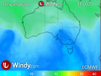
12th of May, 2019, forecast of cold air reaching into north Queensland.
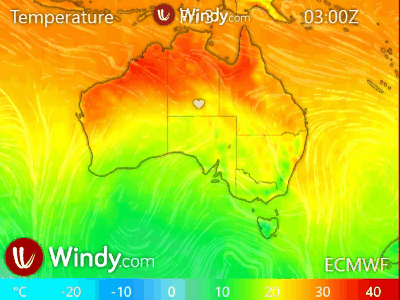
Pressure - cold air from the southern ocean crossing the continent.

Temperature - cool air deep into the north.

The weather cooled-off fairly early from about mid-April this year.
-
@WXcycles
That’s interesting. To show clearly the cold air mass advection over Australia, I would display an animation or a screenshot of temperature at 850hPa. The demo would be more efficient, but need to explain that it is not the temperature at surface level, just the temperature of the air mass. -
Sort of. Within the desert-like interior the air at 600 to 700 hPa is more indicative of what occurs under a winter High pressure system's descending air, with low winds over a rapidly cooling terrain and mostly clear sky. Then surface layer land breezes blow the descending cold air towards the warmer coastline during early morning hours.
600 hPa Temperature (5fps)
-
New snowfall in time for the beginning of Winter.
New Snow.

Temperature at ground level.


Temperature at 10,000 ft.

Pressure and wind flow.
