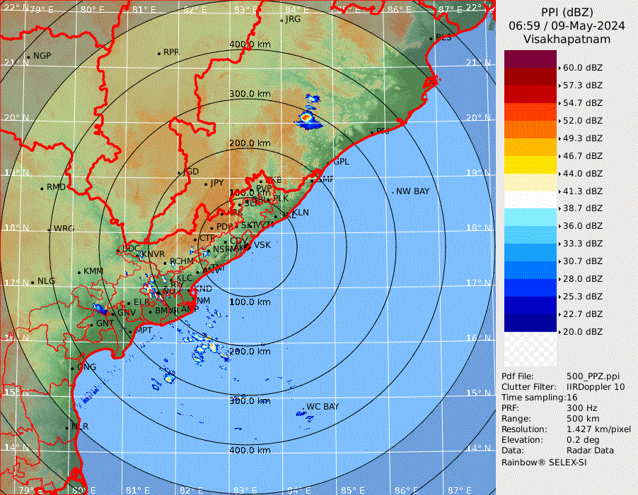
I found some random artifacts in the Radar imagery of India. This is reproducible in mobile version too.
- State boundaries are being shown as clouds in the Radar map
- Lat Long grids are visible as artifacts on the radar map
- The radar imagery is not aligned to the base map.
Check the image below for a better idea:

The state boundaries go away later on but the imagery is still misaligned, and the lat long grid artifact is still there.