Ca y est ! J'ai trouvé l'icone prévisions en bas à droite.
Merci.

Ca y est ! J'ai trouvé l'icone prévisions en bas à droite.
Merci.
Bonjour,
Sur la carte "thermiques", bien utile pour les pilotes de planeur, les orages apparaissent en noir, et sont peu visibles, notamment si l'éclairage est difficile. Je suggère une couleur plus marquante, type violet.
On "thermals" map, which is very useful for gliders pilots, thunderstorms are indicated in black. Then, the visibility is poor, especially in hard conditions for viewing the screen. I suggest another color, for example purple.
Merci.

I changed the colors, and it is much better that way. A great possibility.
A side effect is that thunderstorms are much more visible.

J'ai trouvé la réponse dans la rubrique information de la carte thermiques. J'ai dans l'idée que le chiffre indiqué est sensiblement optimiste, ce qui suscitait ma question.
I got an answer by clicking on the information icon of the map. I have the feeling that the number is rather a bit optimistic. That the reason why I asked the question boundary layer altitude versus ceiling altitude.
Super site en tout cas, plein d'informations !
Super site anyway, plenty of data available.

@Ondřej-Šutera
Hi,
In the middle, 4 favorite locations, on the left and right, 2 radio-sounding locations.
Thanks.
Hello,
Is there a way to retrieve the posts that I made ?
Thanks.
Hi,
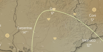
The favorite locations are yellow. And the color of the radio-sounding locations is also yellow. Should it be possible that the radio-sounding locations would be differently colored. This would help readability of the maps.
Thanks.
Hello,
Again, I do not see the thermals altitudes on the maps, but the temperatures. I understood from a former post that the solution was to click on "forecast" icon, but this icon is not available ?
Strangly, on my phone, I have the altitudes.
Thanks for your help.
JP

J'ai trouvé la réponse dans la rubrique information de la carte thermiques. J'ai dans l'idée que le chiffre indiqué est sensiblement optimiste, ce qui suscitait ma question.
I got an answer by clicking on the information icon of the map. I have the feeling that the number is rather a bit optimistic. That the reason why I asked the question boundary layer altitude versus ceiling altitude.
Super site en tout cas, plein d'informations !
Super site anyway, plenty of data available.
@idefix37
Bonjour, j'ai suivi votre recommandation, mais pas réponse !
I followed your suggestion, but no reply to date !
Hello,
I have premium on my pc and my phone. Is it possible to have it on others pc ?
Is there a limitation ? In case of, how many ?
Thanks.
I changed the colors, and it is much better that way. A great possibility.
A side effect is that thunderstorms are much more visible.
Bonjour,
I am also a new user and have a similar question.
What is the "thermal altitude" ?
The top of the boundary layer ?
Or the maximum usable altitude ?
Thanks for the great job